
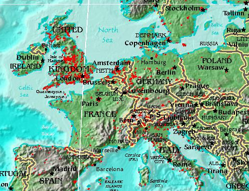
Last week I made a blog post about what we call ‘corrections’ and because a picture is worth a thousand words, here’s where people have been fixing things in Europe …
… and over in the US …
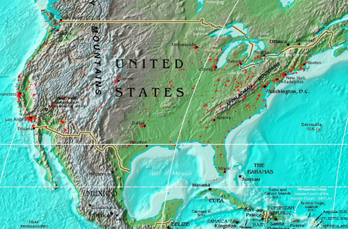
… as expected most of the corrections to neighborhoods are taking place in major cities. Also seemingly most of the UK, presumably because the population is high and our current data is messy (or too abstract) there.
As we get more of this stuff back, the process of feeding it into the system will get underway (in some form or other).
I wonder that as that happens, we’ll see the corrections move away from already heavily corrected locations like cities, or if they’ll continue to be areas that appear to have highly contested borders.
Only time will tell I guess, we’ll keep tracking it.
Map extracts taken from this world map by Serguei.